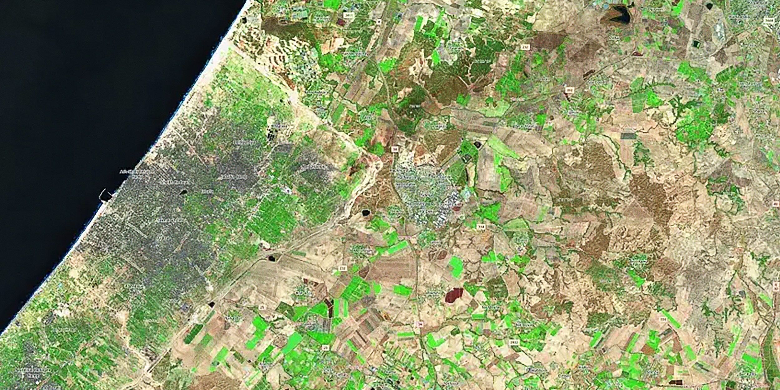
Image: Sentinel-2/European Union Space Programme
The Hamas terrorist attack on Oct. 7, 2023, sent shockwaves through the world.
More than 1,200 people including 700 Israeli civilians were killed in the carnage and further 250 kidnapped by the assailants. Within days, Israel declared a full-on war on Hamas, sending its troops into the 141 square-mile Gaza Strip and urging the 1.1 million inhabitants of its northern part to evacuate within 24 hours. From the beginning of its operations in Gaza, Israel banned international journalists from independently entering the Palestinian territory, only granting select media limited access under strict control of the Israel Defense Forces. With conflicting information being released by the Palestinians and the Israeli authorities, the world was in the dark about what exactly was going on in Gaza.
At that time, Jamon Van Den Hoek, an associate Professor of Geography at Oregon State University in the U.S. began collecting satellite images of the tiny territory, squeezed between the Mediterranean Sea, Israel and Egypt.
Van Den Hoek leads a Conflict Ecology Lab at Oregon State and has, for years, used satellite data to keep track of armed conflicts all over the world. He has mapped the progress of Russia’s invasion of Ukraine, analyzed the destruction wreaked during the siege of Aleppo, the bloodiest battle of the Syrian Civil War, and assessed impacts of Israel’s six-week military operation in Gaza in 2014.
After Israeli tanks rolled into Gaza in October 2023 and bombs began to rain on the strip’s impoverished towns, Van Den Hoek quickly realized that what Israel was telling the world was not the entire story.
“I was shocked to see how quickly the damage accumulated across Gaza and how steady the new damage was appearing,” Van Den Hoek told Supercluster. “With each new satellite image, we consistently saw new damage every single time, spreading into new corners of Gaza.”
Freely available satellite imagery captured by the European radar satellite Sentinel 1 in the first months of the war provided a window into the horrors unfolding on the ground. The once neat patchwork of ochre and brown aridness dispersed among the lush greenery of cultivated fields and the orderliness of human settlements was quickly turning into one messy smudge.
The destruction was progressing at such a mind-boggling speed that within three months from the war’s onset, most of Gaza lay in ruins, Van Den Hoek recalled. At that time, the United Nations had not yet started their own satellite damage mapping effort, and many stakeholders in the international community questioned the conclusions of Van Den Hoek’s team.
“Nowadays, no one is going to disagree that Gaza is extremely damaged,” Van Den Hoek says. “But at the beginning of the war, we got a lot of pushback. People just didn’t want to believe there could be so much damage.”
But the researchers kept going.
In April 2024, about six months after the war started Van Den Hoek and his colleagues from the Decentralized Damage Mapping Group (DDMG), released a study detailing the devastation wreaked by Israeli rockets and troops in the first six weeks of the war.
DDMG is an international initiative leveraging Earth Observation data for conflict and disaster monitoring, founded in 2023.
The study, based on freely available Sentinel-1 data, revealed that in less than two months, the Israeli onslaught badly damaged over 60 percent of Gaza’s hospitals and nearly 70 percent of its schools. In images taken as early as Nov. 26, 2023, the researchers identified substantial damage to 50 percent of buildings in the central parts of Northern Gaza. Later observations showed destruction in up to 84 percent of built-up areas of Northern Gaza.
In the first year of the war, Van Den Hoek and his colleagues kept releasing a new satellite map of Gaza every week, making it available to international journalists, humanitarian organizations and other stakeholders. In year two, they reduced the frequency to once a month.
The unique satellite image chronicle produced by this satellite mapping effort allowed everybody in the world to understand the tragedy unfolding in Gaza almost in real time despite the restrictions and challenges faced by journalists.
Although Palestinian journalists have been free to report from within the territory, the intensity of the war put them at extreme risk. At least 250 reporters and photographers died in the two years of the war; a fact that further contributes to the incompleteness of the ground-based eye-witness account.
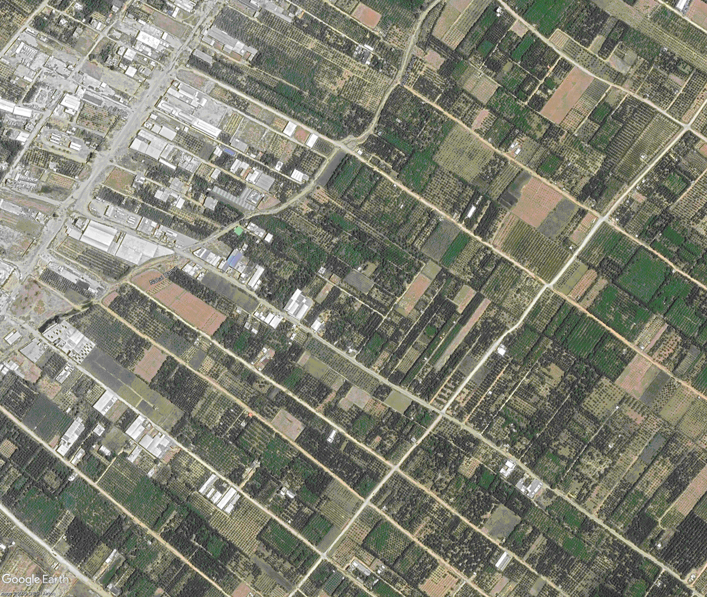
Image: Google Earth
More than two years after the war began, the satellite monitoring project may play a key role in post-war restoration. If efforts spearheaded by the U.S. President Donald Trump succeed, and Gaza’s fragile ceasefire remains in place, ravaged communities and bereaved survivors will begin to ask for justice.
The toll of the two-year war is enormous.
Nearly 70,000 people, mostly civilians, are believed to have died, according to some estimates. Further 1.9 million, about 90 percent of the Gaza Strip population, have been forced to leave their homes, some data suggest. Both sides, Hamas and the Israeli army, have been accused of crimes against humanity. Reconstructing the events of the war will enforce accountability and help survivors to move on.
“Satellite mapping has already been used as supporting documentation in the International Court of Justice case against Israel and in the International Criminal Court investigations around Israel’s war on Gaza,” Lina Eklund, associate professor in physical geography and ecosystem science at Lund University in Sweden and DDMG member, told Supercluster. “In general, high-resolution satellite images have been used to identify human rights violations. Estimates based on satellites can be a way to cross check reports or get a rough idea of the extent of damage.”
The images will also help assess reconstruction needs and costs, she added, and identify the areas most urgently in need of assistance.
For example, a study by DDMG researchers co-led by Eklund and published in February 2025, assessed the scope of damage to Gaza’s agriculture. The paper, based on data from the U.S. commercial satellite constellation Planet and published in the journal Science and Remote Sensing, found that up to 70 percent of tree crops and 58 percent of greenhouses in Gaza had been hit within the first year of the war. In the most battered parts of Northern Gaza and Gaza City, this number rose to nearly 100 percent. The researchers even found that some farmland was turned into parking lots for Israeli tanks.
Restoring Gaza’s fields and greenhouses and removing unexploded landmines from the territory’s agricultural land is necessary to help restore food security in the long term and end the food crisis brought about by the war.
Satellites, Van Den Hoek says, provide a unique vantage point for the mapping of war. Apart from their ability to reach any part of the globe regardless of the situation on the ground, they allow the researchers to distance themselves from the emotional impacts of the human tragedy involved.
“Paying attention to war is extremely difficult,” Van Den Hoek said. “Satellite imagery allows you kind of a mediated distance where you can sort of take it in. You’re not seeing individual suffering. But if you compliment your understanding of the satellite imagery with on-the-ground reporting, it’s nothing short of a horror.”
The continuous satellite mapping has only been possible thanks to the availability of free satellite data from the European Union-owned Copernicus constellation. Although some commercial satellite data has been released by private operators at times, the most detailed imagery has never been made public. Commercial providers such as the American Maxar or the European Airbus restricted access to their high-resolution images of Gaza shortly after the beginning of the war.
“There is no high-resolution imagery of the likes of Maxar over Gaza available because of restrictions from the U.S. State Department,” says Van Den Hoek.
The Copernicus Sentinel-1 radar satellite proved indispensable, providing day-and-night and see-through-cloud imagery with a resolution of up to 10 meters. Optical images from Sentinel-2 offered views in natural colors with a resolution of up to 5 meters, allowing the researchers to trace fires ignited by rocket strikes and map the destruction of vegetation.
Van Den Hoek warns that while the world’s attention has been fixed on Ukraine and Gaza in the past few years, multiple even bloodier conflicts have raged around the world without much notice.
The Yemeni civil war underway since 2014 has killed nearly 400,000 through fighting and hunger. In Sudan, up to 150,000 have perished since 2023, according to some estimates. The Ethiopian Tigray war claimed up to 600,000 civilian lives between 2020 and 2022, making it the deadliest conflict of the 21st century.
“These are underreported wars where we have uncertain impacts on civilians being bombed and targeted in some cases by their own government,” Van Den Hoek says. “These are often clear violations of human rights, and our work is trying to document this for immediate response, recovery efforts, but also for the long-term accountability and peace building effort.
Support Supercluster
Your support makes the Astronaut Database and Launch Tracker possible, and keeps all Supercluster content free.
SupportEklund, however, warns that despite their advantages, satellites fill only a limited part of the puzzle that is the retelling of the tragic story of any war.
“A major advantage of satellites is that we have frequent recordings which can help us track changes over time and get a longitudinal perspective,” she said. “But it's also important to remember the disadvantages of satellite images, for example the fact that we can only assess what is going on on the ground, while it's difficult to attribute changes to certain activities or events.”
At the time of writing, the ceasefire in Gaza is extremely fragile.
Few believe in lasting peace. Reports of breaches on both sides, including an Israeli air strike that killed a hundred people in response to alleged Hamas violence at the Rafah border, have been coming in basically from the day when the peace deal was agreed. Whatever happens in the coming months, the satellites will keep watching. Although, as Van Den Hoek says, not much is left to damage. Most of Gaza was flattened in the first three months after the Hamas terrorist attack on Israel.
Despite the unsettled state of affairs, Van Den Hoek has hope that the work he and his colleagues have committed to will one day help the region move forward. When that might be, he is less certain of.
“This is a very violent period of time,” he says. “Possibly the most violent since the second World War. “Coming out of this, there has to be some accountability for what happened. There has to be something on the books, not just in terms of assigning blame, but in terms of grappling what has happened and setting a path forward that accounts for the impacts of war on civilian population and infrastructure.”